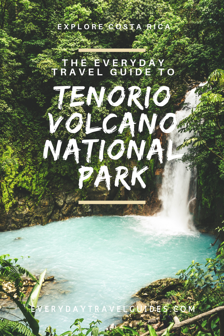
The Everyday Travel Guide to Tenorio Volcano National Park, Costa Rica

by Rebecca Hollman
updated May 25, 2018
Introduction to Tenorio Volcano
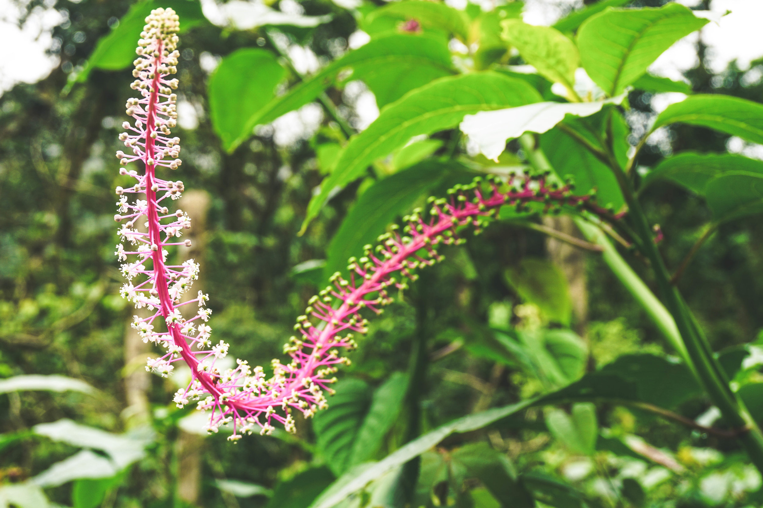
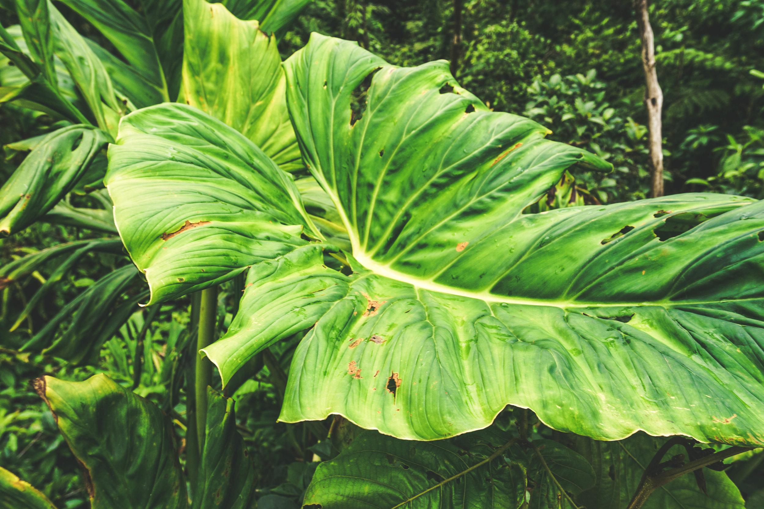
Tenorio Volcano National Park is located in the Alajuela Province of Costa Rica close to the town of Bijagua. This is one of the youngest national parks in Costa Rica and was created in 1995 to protect the Tenorio Volcano and surrounding area from development. The park features different ecosystems including cloud forest, rainforest and river habitats and tons of diverse wildlife, especially many species of birds.
Table of Contents
More About the Volcano
Tenorio Volcano actually consists of a cluster of many volcanic peaks and craters and finishes off the southeast end of the Guanacaste Volcano Range known as La Cordillera de Guanacaste. This range is 110 km long and stretches from the northwest corner of Costa Rica near the Nicaraguan border, all the way to the southeast corner. It contains many peaks including Miravalles (the tallest at 2,028 meters), Rincon de la Vieja, Tenorio, Orosí and Arenal. Tenorio is the third tallest peak at 1,916 meters. The Tenorio complex is formed of the principal peak- Tenorio and also a peak to the north, Volcan Montezuma. Montezuma itself has twin peaks and Tenorio has three peaks. No known recent eruptions have come from Tenorio.
More About the Color of Río Celeste
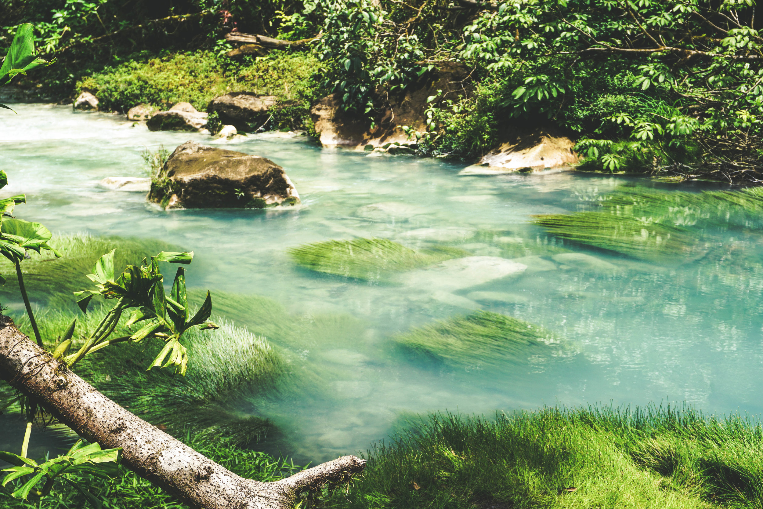
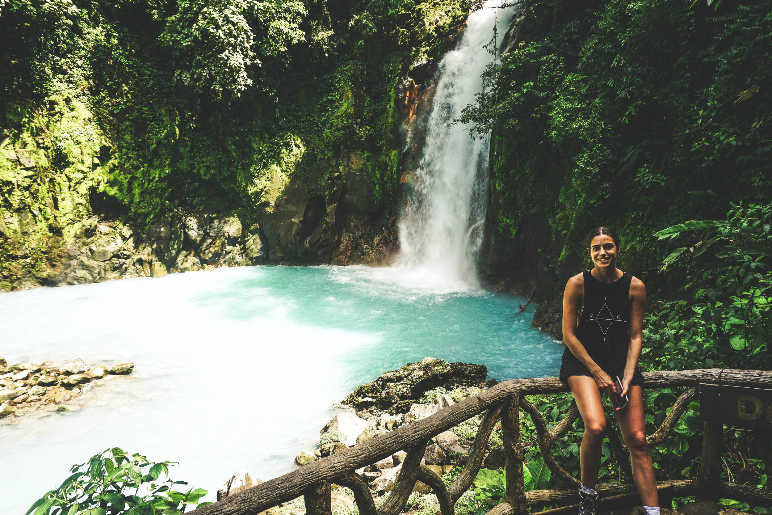
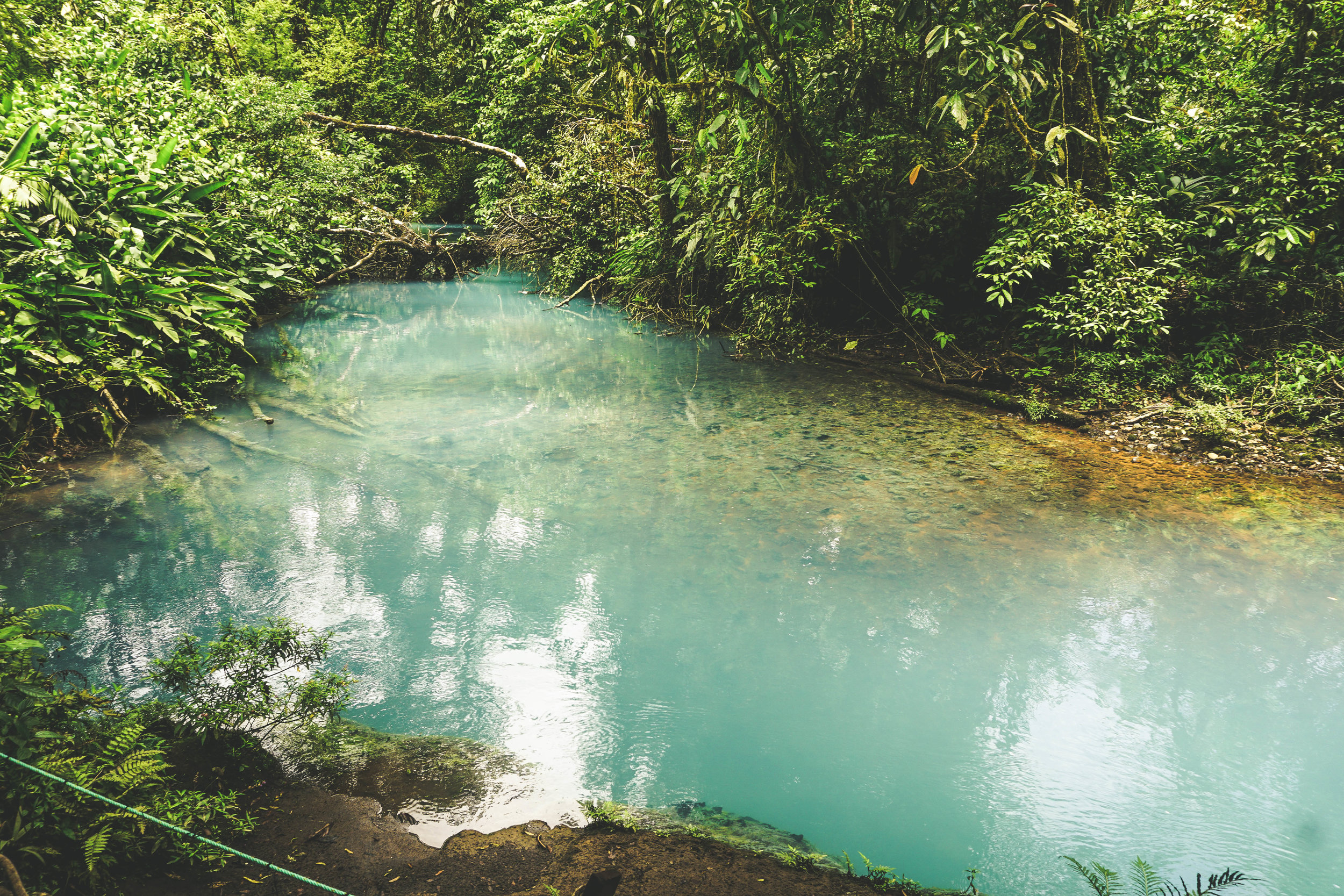
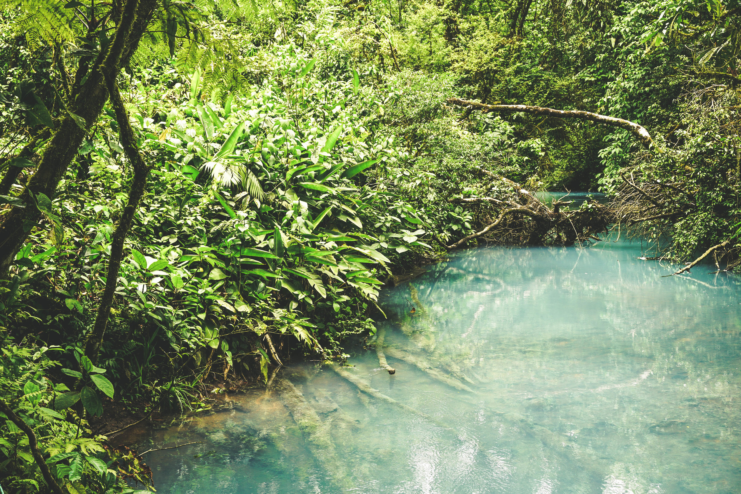
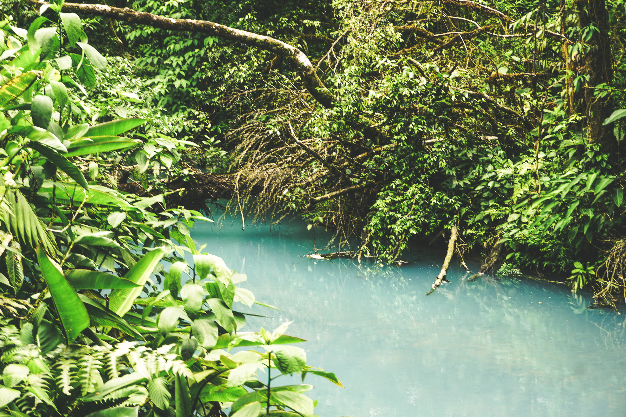
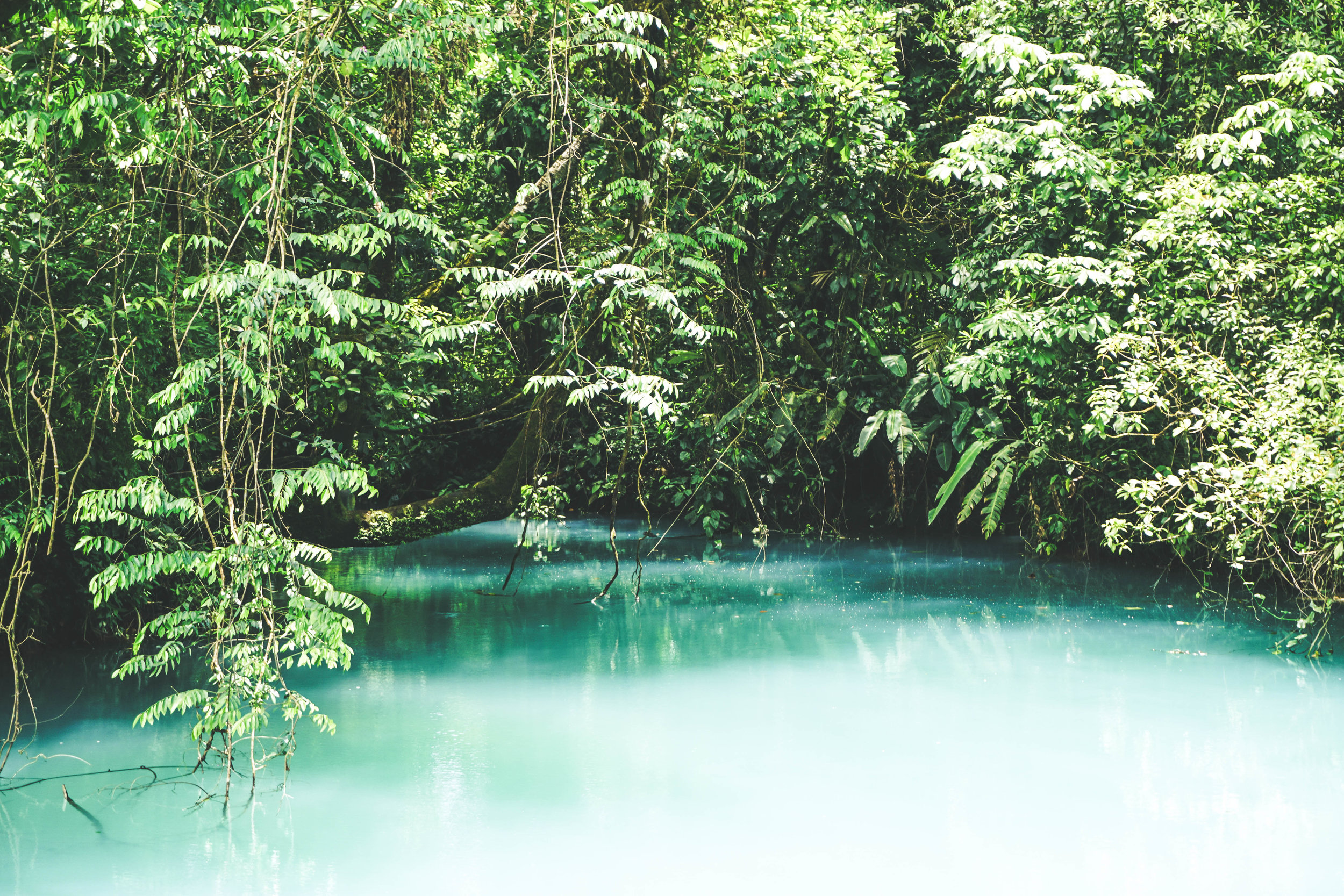
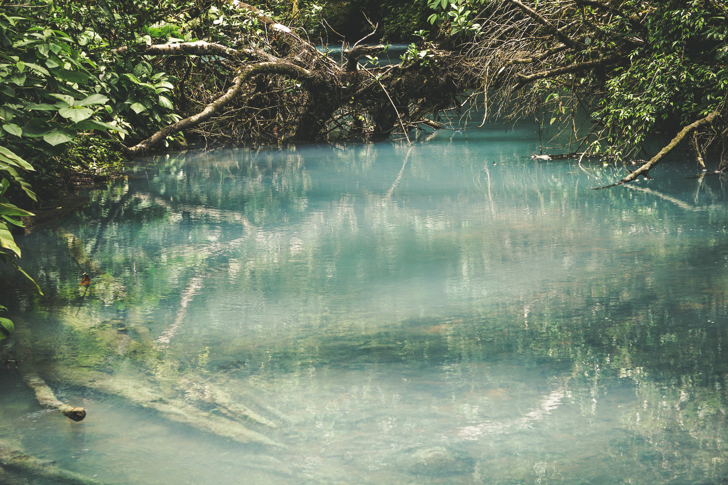
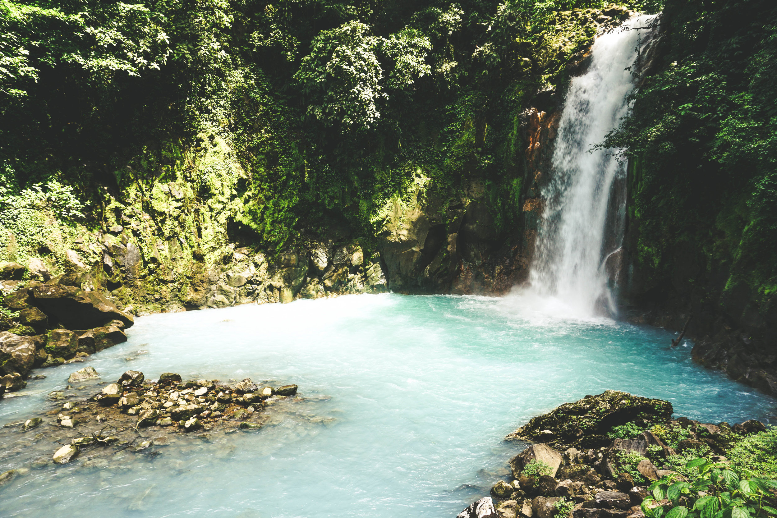
The Río Celeste is a bright blue river that runs through Tenorio Volcano National Park and has hot springs and one waterfall. Two colorless rivers- Buenavista River and Sour Creek- fed the Río Celeste. The Buenavista river is high in small aluminosilicate particles and the Sour Creek river is extremely acidic. The pH change in the mixing point of these two rivers increases the particle size of the aluminosilicate in the Buenavista River from 184 nanometers to 570 nanometers. Some of this particle deposits and reaches the bottom of the river, where it can be seen as white sediment. The majority of it remains suspended along the Río Celeste. The remaining suspended mineral particles scatter sunlight just as when raindrops form a rainbow. The specific size of the particles in the river causes it to scatter sunlight and scatter out lightwaves that are the same size as the particle- i.e. 570nm particles gives 570nm wavelengths. This scatters out light blue/green light which is what we are able to perceive with our eyes- giving the river its unique turquoise color. This phenomenon is called Mie scattering.


Hiking Tenorio Volcano National Park
Trails Inside the Park
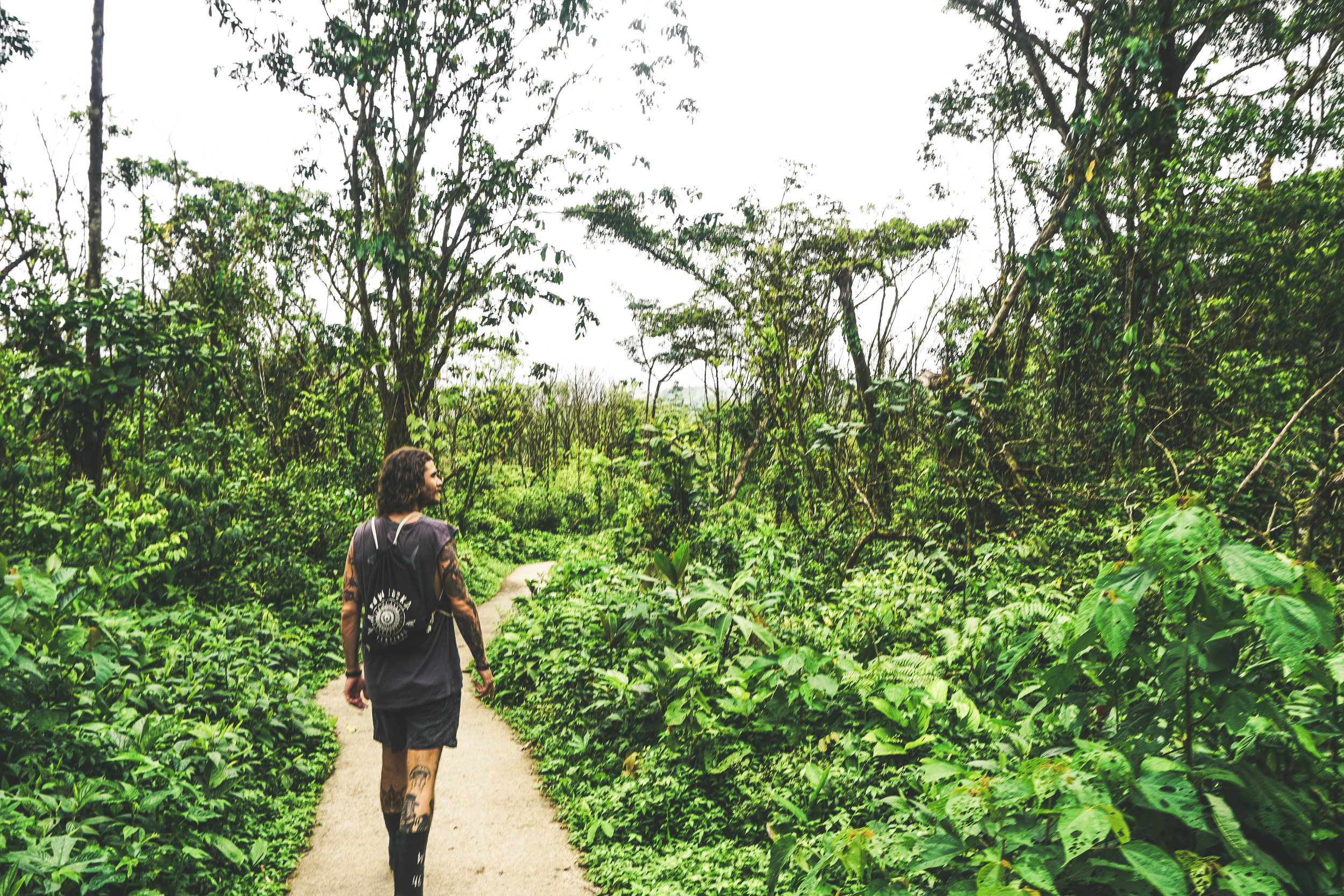
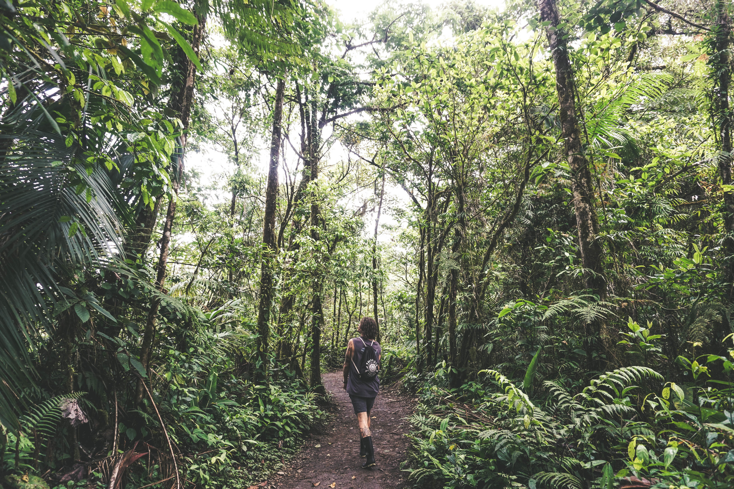
1. Sendero Río Celeste
Distance: 3 km each way (6 km round trip)
Difficulty: Moderate
Why you should do it: The river and the waterfall are absolutely stunning. This is one of the must-do's in Costa Rica.
Things to note: This trail is muddy and slippery in sections (mostly after the branch off for the Río Celeste lookout) so bring appropriate shoes and be prepared to get dirty. Also there is no swimming allowed in the waterfall or in the river. Also, the trail to the waterfall lookout is a couple hundred steps down so be prepared to walk back up these steps if you go all the way down. This part can be strenuous so don't do it if you have pre-existing complications.
Pro tip: Follow the trail past the waterfall lookout and all the vista points all the way to the very end where you see the water mixing and the calcium carbite streak where the water turns into the baby blue color you see. Then walk the trail backwards, stopping at all the view points one by one on your way back- saving the waterfall lookout for last.


Getting There
Directions
From Liberia: Take Highway 1 south from Liberia towards Canas until you reach an intersection with Route 6. Take a right onto Route 6 and follow it all the way to the town of Bijagua. Passing through the town, you will see a sign on the right for Tenorio Volcano National Park. Turn right here and continue following signs until you reach a gravel parking lot with an attendant. Note that the last 10 km of road are unpaved so 4 wheel drive is recommended but really not necessary.
From San Jose: Take Highway 1 to Canas. Continue 10 km past Canas until you reach an intersection with Route 6. Take a right onto Route 6 and follow it all the way to the town of Bijagua. Passing through the town, you will see a sign on the right for Tenorio Volcano National Park. Turn right here and continue following signs until you reach a gravel parking lot with an attendant. Note that the last 10 km of road are unpaved so 4 wheel drive is recommended but really not necessary.
Park Hours
8:00 AM to 4:00 PM daily
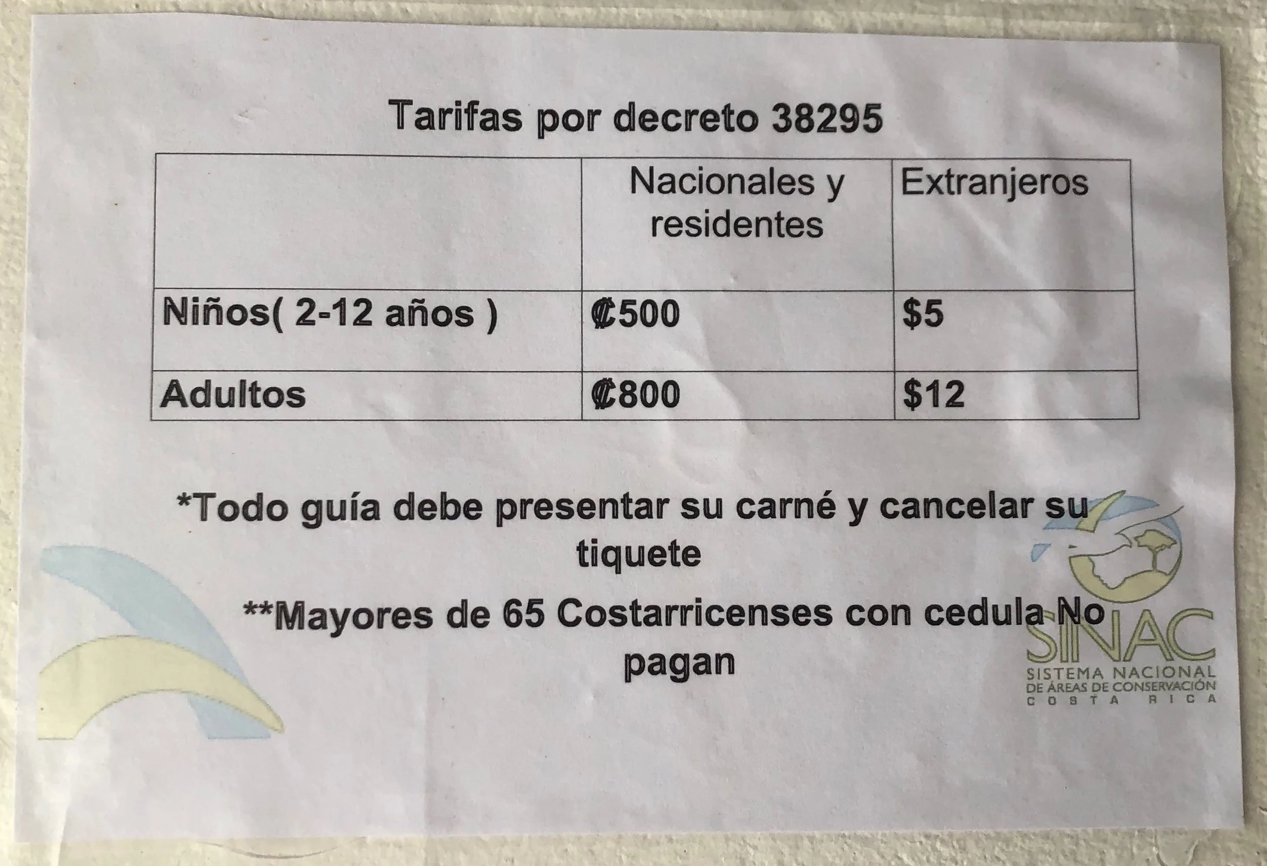
Park Admission Price
For nationals: [FIND OUT]
For foreigners: $12 USD
Other Activities Close to Tenorio Volcano National Park
1. Miravalles Hot Springs- There are three main hot springs located near Miravalles. These are Yoko Termales, Colinas del Miravalles and Thermomania. Yoko Termales and Colinas del Miravalles are both hotels that offer day passes to their hot springs and pools. The pools at Yoko Termales surround a restaurant and bar. The pools at Colinas del Miravalles are much more isolated. I would highly recommend this location at sunset into night-time. Watching the sunset over the volcano is amazing and then staying in the warm pools into the night gives you an incredible view of the stars in the night sky. Thermomania is more of a water park featuring water slides and lots of kids.
2. Las Hornillas and Miravalles Volcano- Las Hornillas is at the base of Miravalles Volcano and allows visitors to walk across an active crater where there are hot water pools, boiling mud pits and fumeroles. After hiking around this area, spend the rest of the time enjoying the sauna, mud baths and hot springs.
Learn more about Las Hornillas HERE
4. Llanos de Cortez- This waterfall is located in the town of Bagaces, just 30 minutes south of Liberia and right off Highway 1. It is easily accessible from Liberia, Rincon de la Vieja, Miravalles, and even Tamarindo. There is a quick 15-20 minute hike to this free waterfall where you can swim in a pool formed from the falls. Since it is easily accessible (right off the highway) and free, it is a good option for a half day trip. Stop on the way into or out of Rincon de la Vieja if you want to have a dip in a refreshing natural pool.
Times: 8:00 AM to 4:30 PM daily
Admission: Free but donations to the nearby schools are appreciated
Directions: Off Highway 1, approximately 30 minutes to the south of Liberia. Search Llanos de Cortes on Googlemaps and it will bring you to the small town of Llanos de Cortes by the falls. From there, you should see signs for the waterfall that lead to a big parking area.
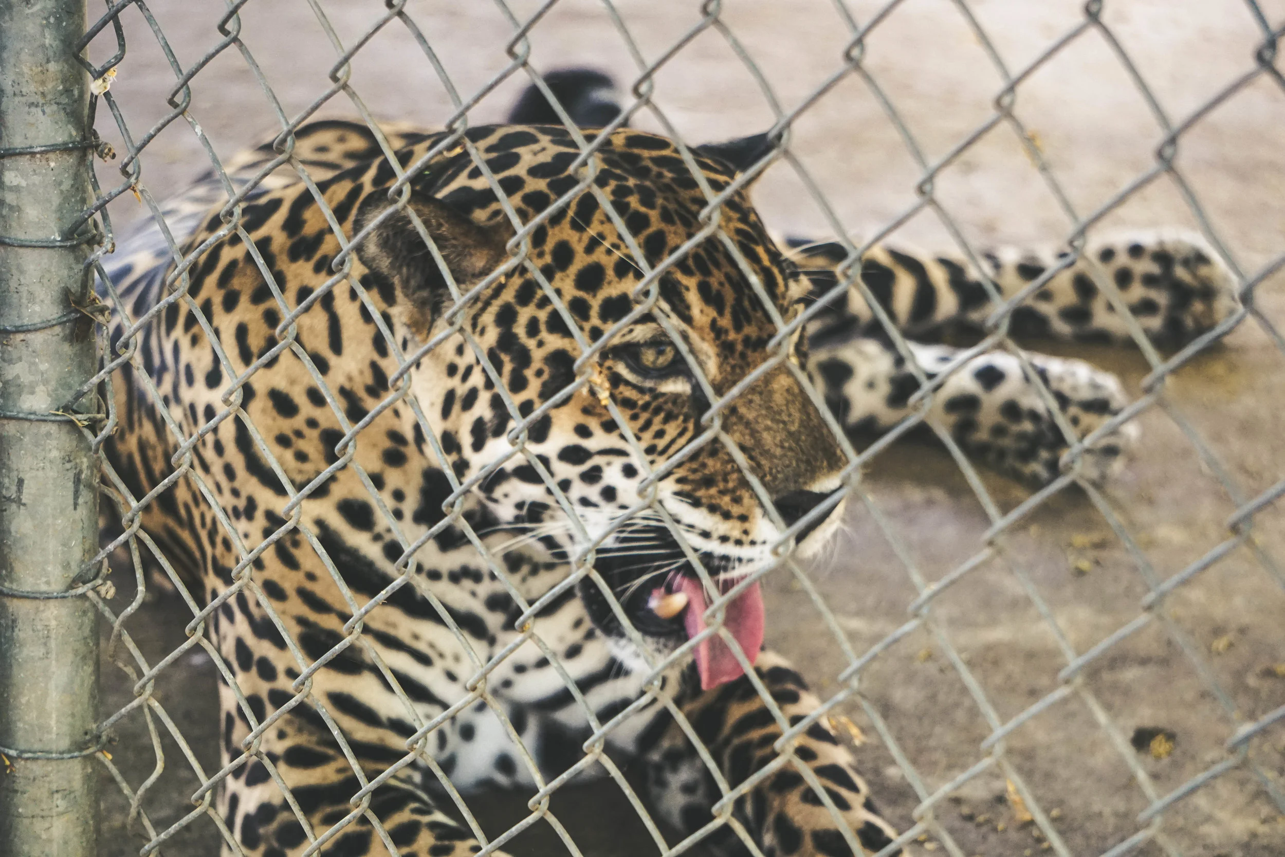
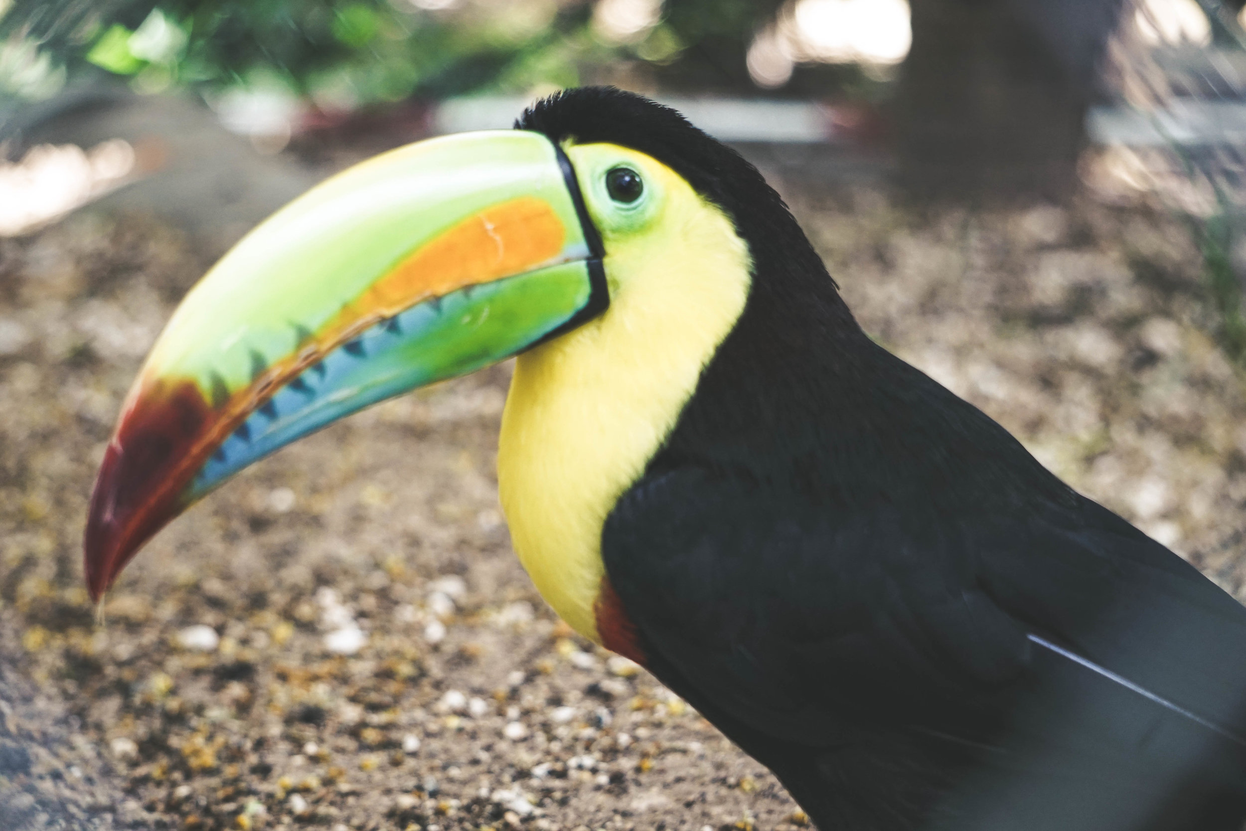
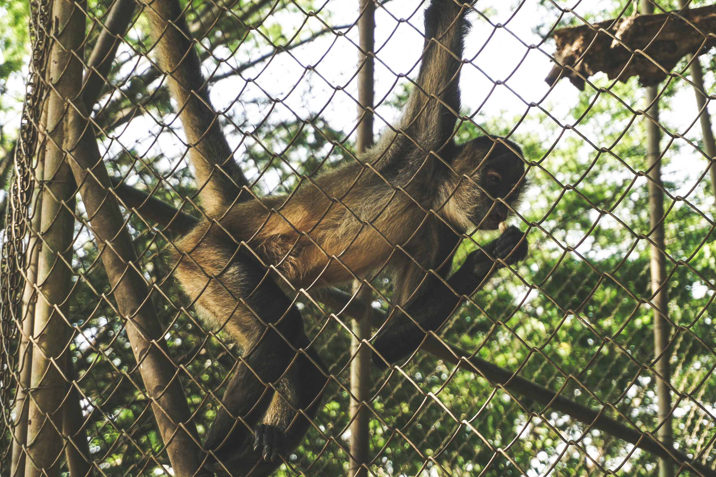
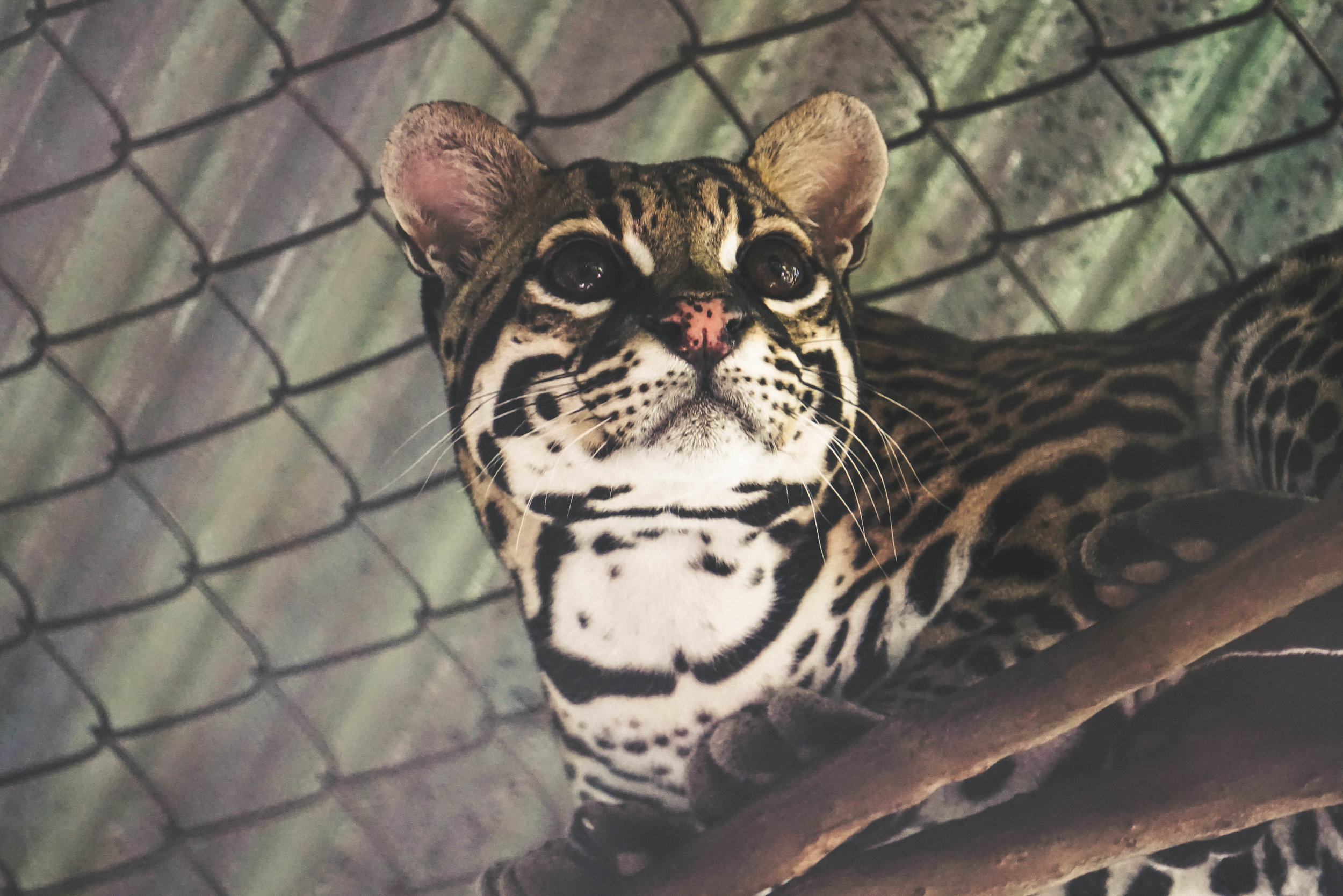
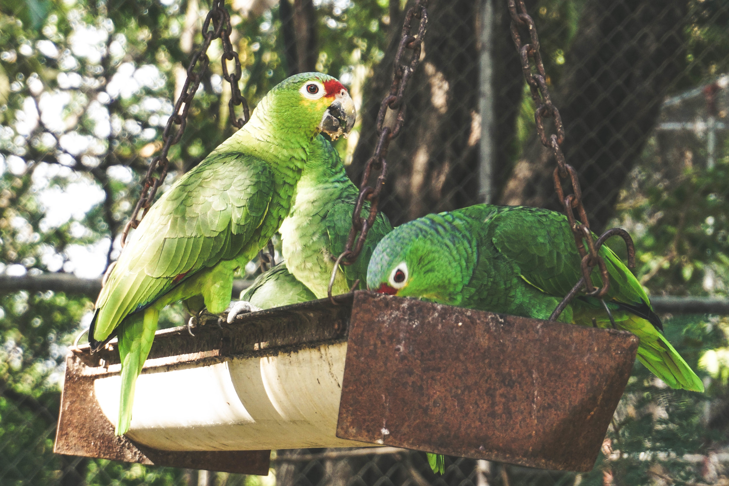
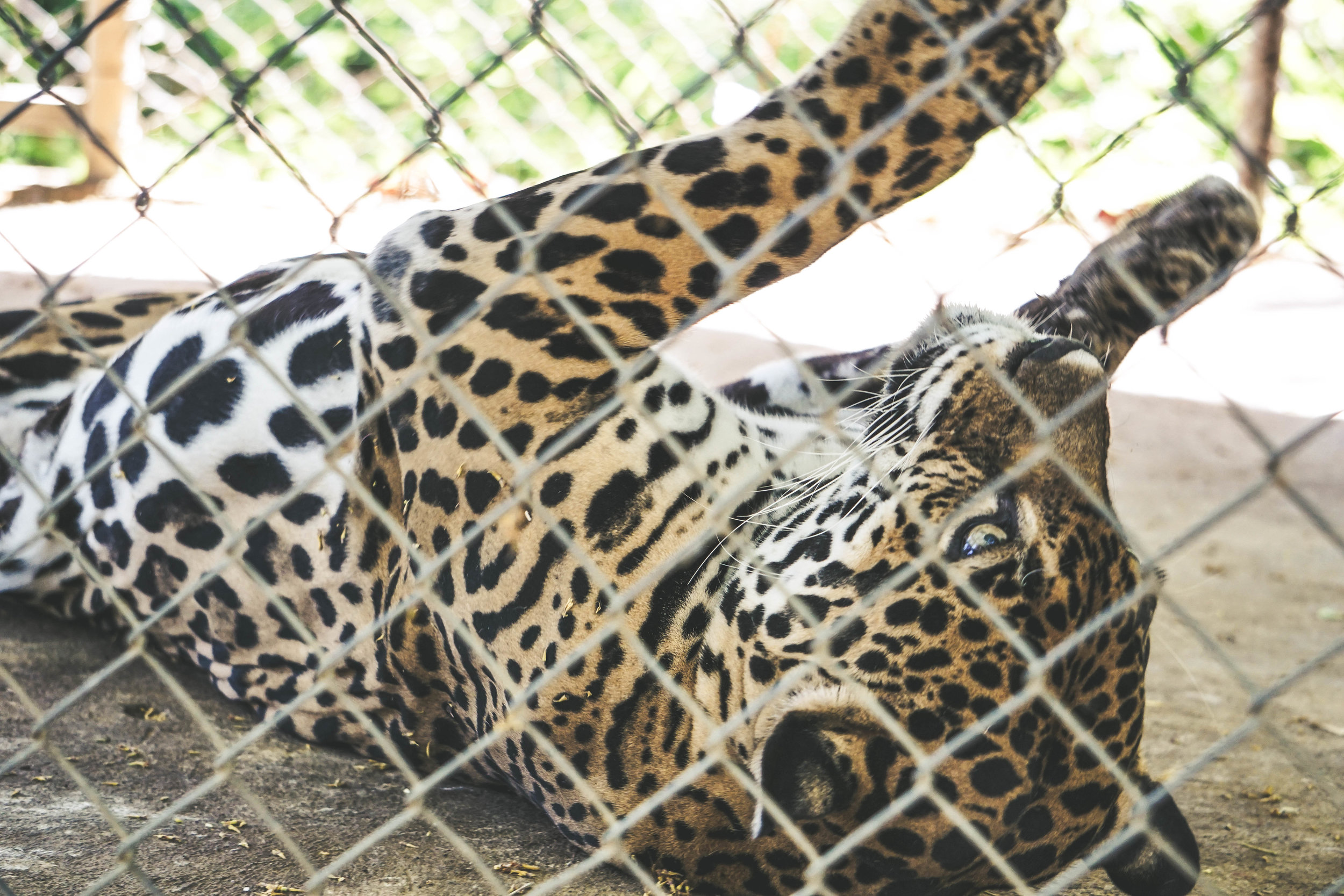
5. Las Pumas Rescue Center- Las Pumas is a non-profit rescue center off Highway 1, close to Llanos de Cortez. It is a great educational center for children but is also a good stop for adults. This center mostly contains animals that are unfit to be returned to the wild and provides permanent homes for them. Some of these animals include jaguars, ocelots, margays, toucans, macaws, pumas, spider monkeys, howler monkeys, capuchins, peccaries, parrots, jaguarundis and many more. There are guides willing to give anyone a tour and most speak very good English.
Times: 8:00 AM to 4:00 PM daily
Admission:
For nationals:
Children from 4 to 12 years old: ¢ 1,000 colones
Students over 12 years old: ¢ 2,000 colones
Adults: ¢ 3,000 colones
For foreigners:
Children and students (+12 years): $ 8 dollars
Adults: $ 12 dollars
Directions: 4.5 km from Cañas, on the way to Liberia on the InterAmerican Highway (Highway 1), Guanacaste, Costa Rica.
6. Hiking in Rincón de la Vieja National Park- A bit farther away (about 2.5 to 3 hours by car) is Rincón de la Vieja Volcano National Park. This national park features two sectors, a good amount of trails, tons of geothermal features and waterfalls you can swim in.
Read my post about The Complete Travel Guide to Rincón de la Vieja Volcano National Park HERE
7. Hiking in Arenal Volcano National Park- Another longer drive, Arenal Volcano National Park, Lake Arenal and the town of La Fortuna are about 1.5 to 2 hours by car. This national park has a two sectors and a few trails but other highlights in the area include kayaking/paddle boarding in Lake Arenal, La Fortuna waterfalls, the town of La Fortuna and other activities nearby.
Read my entire post about The Complete Travel Guide to Arenal Volcano National Park and The Best Things To Do in La Fortuna, Costa Rica HERE and HERE